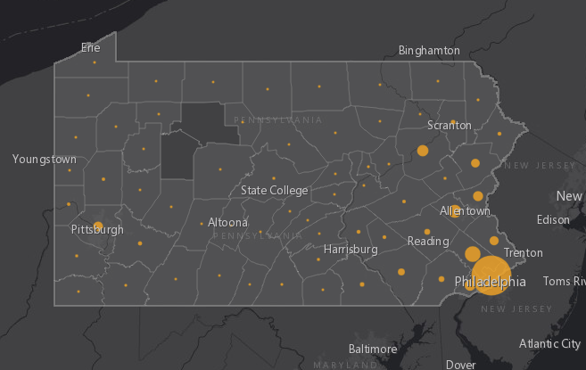
Residents of Pennsylvania can monitor the spread of COVID-19 across the commonwealth with an online dashboard created by researchers at Penn State. The dashboard, which has been available since March 12, provides a map of the state with the number of confirmed COVID-19 cases represented by county.
Updated daily, the dashboard also presents graphics that help to visualize this spread, including ways to look for a “flattening of the curve” that would indicate that our efforts to slow the spread of the virus are working.
“We wanted to help people in Pennsylvania understand what is happening in the state,” said Brittany Waltemate, a maps and GIS assistant supported by the Sally W. Kalin Endowment for Technological Innovations, to work in the Donald W. Hamer Center for Maps and Geospatial Information. The center is part of the Penn State University Libraries Department of Research Informatics and Publishing.
Working in partnership with Nathan Piekielek, the geospatial services librarian and assistant professor of geography, Waltemate said the dashboard is evolving as new data becomes available.